
Product · Truck GPS
Truck GPS and truck tracking for construction transport
The driver navigates. The dispatcher sees the trucks. The site sees its own truck arriving.
In Nereva, GPS is part of the mission. Nereva Transports guides the driver with heavy-vehicle navigation. The Transport back office shows the dispatcher where the trucks are and what they are doing. Nereva Commandes shows the site the truck linked to its request. HERE truck mapping and routing, and nothing to install on the trucks.
15-day trial with 2 licences. No payment method required.

Three uses, one data source
The same GPS, seen from the truck, the dispatch desk and the site
The truck’s position comes from the driver’s app during the mission. Everyone sees what concerns them.
Driver
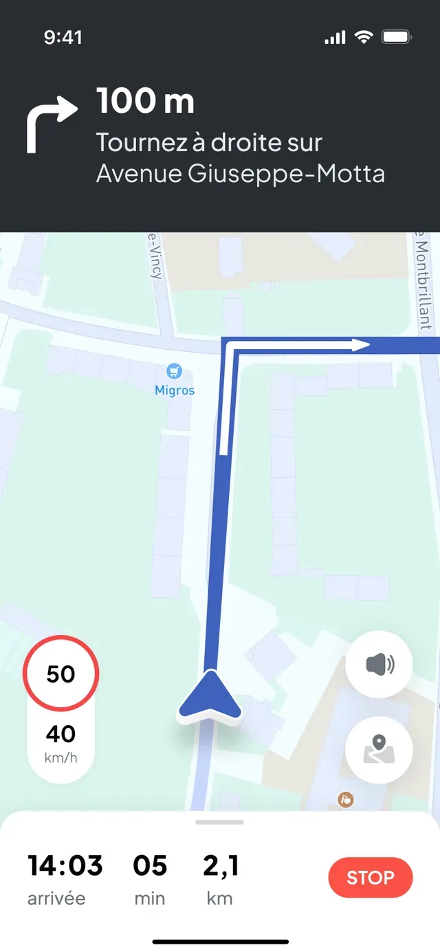
Nereva TransportsOpens the mission and starts heavy-vehicle navigation: a route calculated for the truck, traffic taken into account, distance and arrival time.
See the navigationDispatcher
Transport back officeSees the trucks on mission on the map, with the operation in progress, next to the schedule.
See the mapSite
Nereva CommandesSees the truck linked to its request approaching, with the estimated arrival time. Not the carrier’s fleet: its own truck.
See the approaching truck
Heavy-vehicle navigation starts from the mission
No address to retype into another GPS: the mission carries the drop-off or collection location, and guidance starts with one tap. The route is calculated for a heavy vehicle with HERE mapping and routing, and it takes traffic and congestion into account.
- Route optimised for the truck, with duration and distance before leaving.
- Turn-by-turn guidance, arrival time and remaining distance in the cab.
- Traffic and congestion taken into account when the route is calculated.
- Mileage calculated for the route, distance travelled recorded for the mission.
- Navigation even without a network: heavy-vehicle GPS navigation keeps working without a network connection.
If the request changes on the way, the driver is notified in the app and restarts navigation to the new address.
Discover Nereva Transports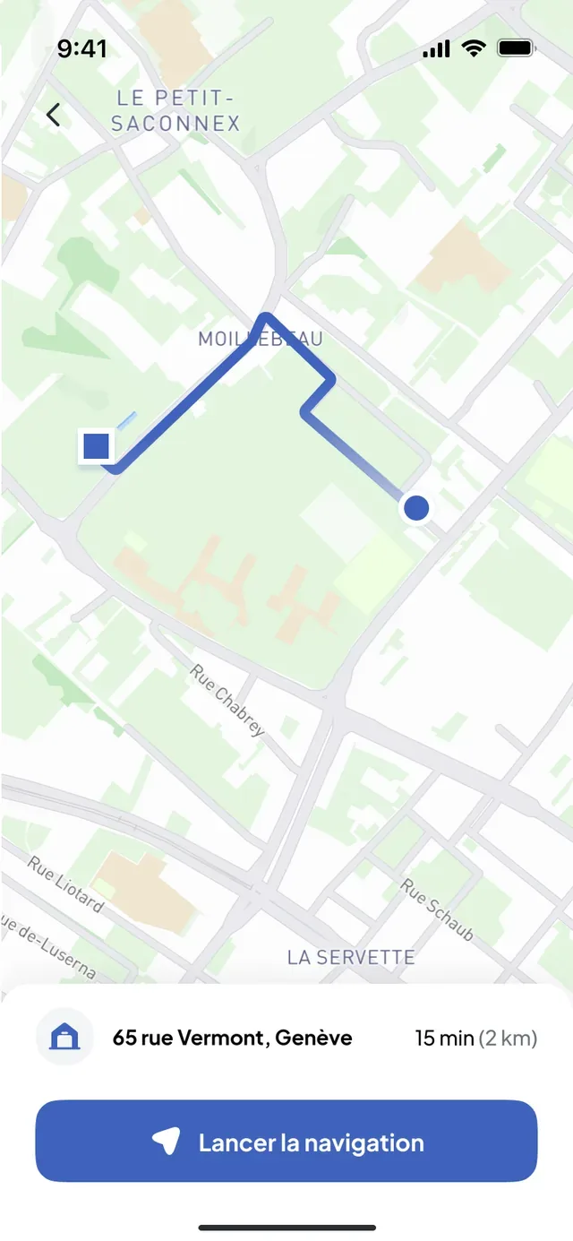
Dispatcher · Transport back office
Where are my trucks, and on which operation?
During missions, the trucks appear on the Transport back office map, together with the sites and the depots. Nothing to install: the position comes from the driver’s app. The dispatcher sees who is on the road and who is on site, and adjusts the schedule with the real situation in view.

- During the mission onlyThe position is shared from the acceptance of the mission to its closure, never during breaks or personal time.
- Never for surveillanceGeolocation is never used to monitor, rank or sanction a driver individually.
- Together with the schedulePositions, missions in progress and the schedule are in the same back office: the dispatcher reschedules without a call.
The site sees the truck linked to its request approaching
When the carrier and the site use Nereva on the same flow, the foreman sees in Nereva Commandes the truck of his request on its way and its estimated arrival time, updated during the mission. He frees up access at the right moment, without a call.
The site does not see the carrier’s fleet: only the truck linked to its request and its operation. The carrier keeps its schedule and its other clients to itself.
Discover Nereva Commandes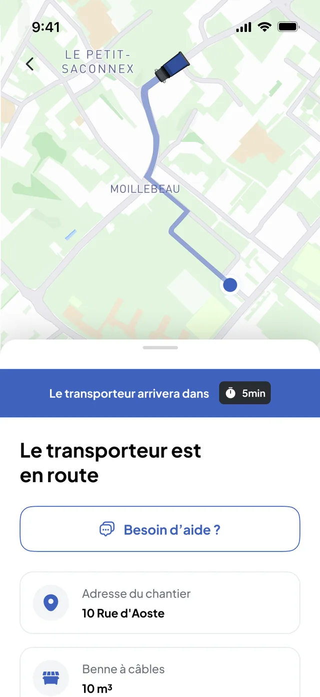
One mission, one data source
GPS follows the mission, from dispatch to closure
- 01
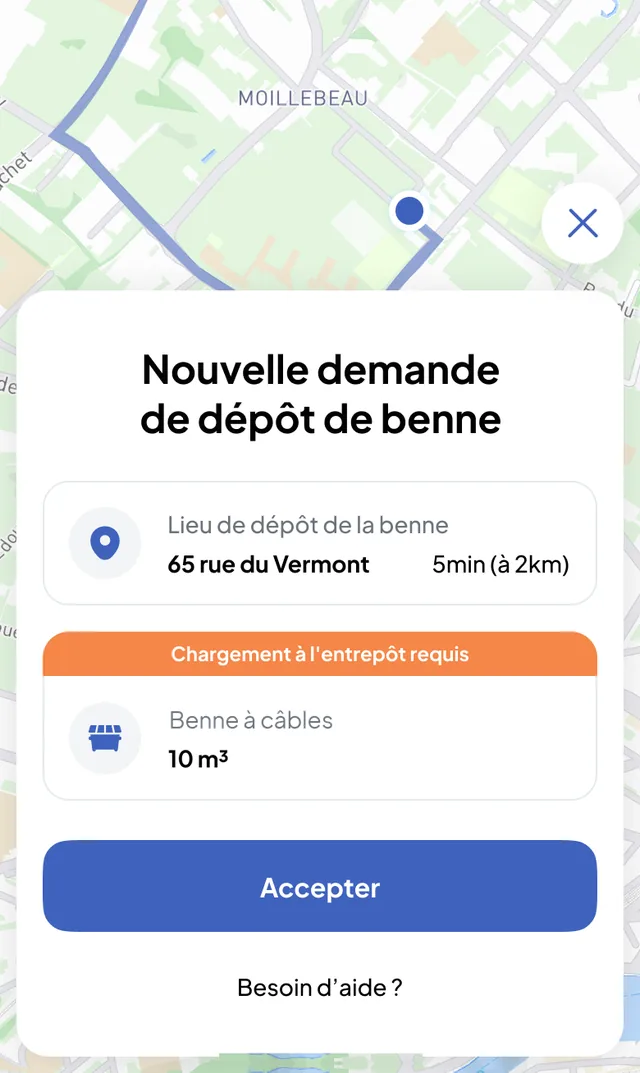
Mission accepted
The driver accepts the mission in Nereva Transports. From then on, the truck’s position is shared.
- 02
Route calculated
Mission location, HERE truck mapping and routing, traffic: the driver sees the duration and the distance, then starts navigation.
- 03
Truck on its way
The dispatcher sees the truck on the map; the site sees its truck approaching and the estimated arrival time, if it is on Nereva.
- 04
Mission closed
The position stops. The distance travelled and the GPS trace stay attached to the mission, with the photos and the delivery notes.
The carrier can use all of this on its own, even if its clients are not on Nereva yet: navigation, positions, schedule and missions work in its back office and its app. Synchronisation with the site is added when the client joins Nereva. Discover Transport
Mapping technology
What HERE provides, what Nereva adds
Truck mapping and routing
Nereva relies on HERE technology for mapping and heavy-vehicle routing, integrated into Nereva Transports. On-board navigation and positions go through this integration. HERE is a technical provider of Nereva, named in our general terms of use and our privacy policy.
The mission, synchronisation and proof
Nereva adds what a map does not know: the exact location of the mission, the truck and driver assigned, the sharing of the position with the dispatcher and the site, the estimated arrival time, then the distance travelled and the GPS trace attached to the mission with the photos and the delivery notes.
Truck or skip?
GPS tracks the truck. The skip is managed.
Truck = GPS
The position comes from the driver’s app, during the mission. It is the truck that is located, with the operation it is carrying out.
Skip = management
A skip has a type, a volume and a status: at the depot, on site, on a truck or in maintenance. The fleet of skips is followed by type and by status, with the history of movements, and each site shows the skips present. Individual identification of each skip is in development.

Your questions
Nereva’s GPS, in plain terms
Is Nereva’s GPS designed for heavy vehicles?
Yes. Navigation in Nereva Transports calculates routes for heavy vehicles with HERE truck mapping and routing. Guidance starts from the mission, without entering an address, right to the mission location.
Can the dispatcher see the trucks?
Yes. During missions, the trucks appear on the Transport back office map, together with the sites and the depots. Nothing to install: the position comes from the driver’s app.
Can the site see the truck approaching?
Yes, when the carrier and the site use Nereva on the same flow. In Nereva Commandes, the site sees the truck linked to its request and its estimated arrival time. It does not see the rest of the carrier’s fleet.
Does Nereva geolocate each skip?
No. GPS tracks the truck on mission. Skips are managed by type and by status (at the depot, on site, on a truck, in maintenance), with their history. Individual identification of each skip is in development.
Can a carrier use the GPS without its client using Nereva?
Yes. Navigation, truck positions, schedule and missions work for the carrier on its own. Synchronisation with the site is added when the client joins Nereva.
Is traffic taken into account?
Yes. Route calculation takes traffic and congestion into account. The duration and the estimated arrival time are updated during the mission.
Does Nereva calculate the distance travelled?
Yes. The mileage of the route is calculated before departure, and the distance travelled is recorded for each mission. Kilometres travelled are available in the Transport back office dashboard.
Is geolocation used to monitor drivers?
No. It is only active during the mission, from its acceptance to its closure, never during breaks or personal time, and it is never used to monitor, rank or sanction a driver individually.
Does navigation work without a network?
Yes. Heavy-vehicle GPS navigation keeps working even without a network connection. Sharing the position with the dispatcher and the site resumes when the connection returns.
All questions about tracking and geolocation are in the FAQ.
Going furtherNavigation built for heavy vehicles, even without network coverage.
15-day free trial with 2 licences. No payment method required. Then a monthly subscription, with no fixed term.